


AEOLUS CAMPAIGN WILL TAKE PLACE IN SEPTEMBER 2021
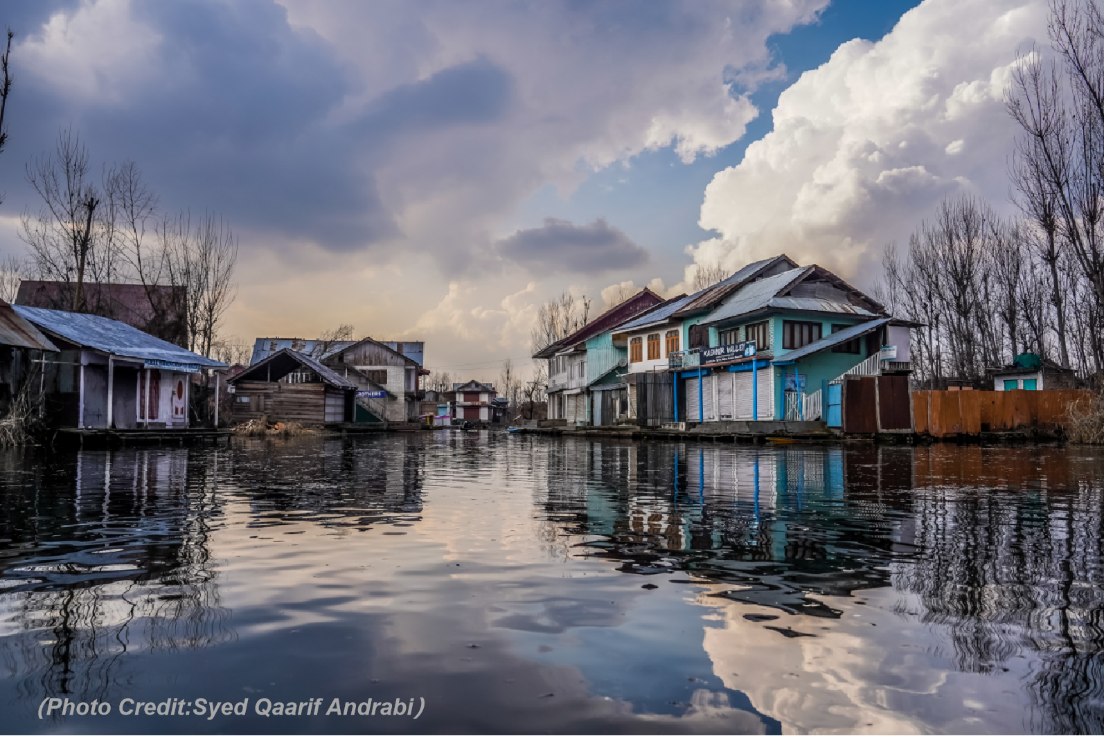
After two postponements, the Aeolus Tropical Campaign will finally take place inSeptember 2021 on the Cape Verde Islands, off the coast of West Africa. The German (German Aerospace Center, DLR) and French (Service des Avions Français Instrumentés pour la Recherche en Environnement, SAFIRE) Falcon aircraft will fly out of Sal airport, while the US American DC-8 (National Aeronautics and Space Administration, NASA) will be stationed on the US Virgin Islands and visit Cape Verde for intensive measurement periods. The research flights will be accompanied by radiosonde launches operated by the Karlsruhe Institute of Technology and by ground-based dust remote sensing measurements from the island of Mindelo (ASKOS: https://askos.space.noa.gr). In addition to Cal/Val activities for the space-borne wind and aerosol lidar on the Aeolus satellite, scientific investigations will target African Easterly and other Equatorial Waves, tropical cyclogenesis, dust outbreaks from the Sahara and mesoscale convective systems.
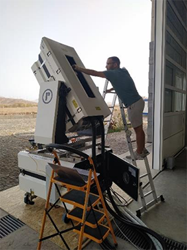
Preparing equipment for an Aeolus overpass in Mindelo
After two postponements, the Aeolus Tropical Campaign will finally take place inSeptember 2021 on the Cape Verde Islands, off the coast of West Africa. The German (German Aerospace Center, DLR) and French (Service des Avions Français Instrumentés pour la Recherche en Environnement, SAFIRE) Falcon aircraft will fly out of Sal airport, while the US American DC-8 (National Aeronautics and Space Administration, NASA) will be stationed on the US Virgin Islands and visit Cape Verde for intensive measurement periods. The research flights will be accompanied by radiosonde launches operated by the Karlsruhe Institute of Technology and by ground-based dust remote sensing measurements from the island of Mindelo (ASKOS: https://askos.space.noa.gr). In addition to Cal/Val activities for the space-borne wind and aerosol lidar on the Aeolus satellite, scientific investigations will target African Easterly and other Equatorial Waves, tropical cyclogenesis, dust outbreaks from the Sahara and mesoscale convective systems.
After two postponements, the Aeolus Tropical Campaign will finally take place inSeptember 2021 on the Cape Verde Islands, off the coast of West Africa. The German (German Aerospace Center, DLR) and French (Service des Avions Français Instrumentés pour la Recherche en Environnement, SAFIRE) Falcon aircraft will fly out of Sal airport, while the US American DC-8 (National Aeronautics and Space Administration, NASA) will be stationed on the US Virgin Islands and visit Cape Verde for intensive measurement periods. The research flights will be accompanied by radiosonde launches operated by the Karlsruhe Institute of Technology and by ground-based dust remote sensing measurements from the island of Mindelo (ASKOS: https://askos.space.noa.gr). In addition to Cal/Val activities for the space-borne wind and aerosol lidar on the Aeolus satellite, scientific investigations will target African Easterly and other Equatorial Waves, tropical cyclogenesis, dust outbreaks from the Sahara and mesoscale convective systems.
After two postponements, the Aeolus Tropical Campaign will finally take place inSeptember 2021 on the Cape Verde Islands, off the coast of West Africa. The German (German Aerospace Center, DLR) and French (Service des Avions Français Instrumentés pour la Recherche en Environnement, SAFIRE) Falcon aircraft will fly out of Sal airport, while the US American DC-8 (National Aeronautics and Space Administration, NASA) will be stationed on the US Virgin Islands and visit Cape Verde for intensive measurement periods. The research flights will be accompanied by radiosonde launches operated by the Karlsruhe Institute of Technology and by ground-based dust remote sensing measurements from the island of Mindelo (ASKOS: https://askos.space.noa.gr). In addition to Cal/Val activities for the space-borne wind and aerosol lidar on the Aeolus satellite, scientific investigations will target African Easterly and other Equatorial Waves, tropical cyclogenesis, dust outbreaks from the Sahara and mesoscale convective systems.
After two postponements, the Aeolus Tropical Campaign will finally take place inSeptember 2021 on the Cape Verde Islands, off the coast of West Africa. The German (German Aerospace Center, DLR) and French (Service des Avions Français Instrumentés pour la Recherche en Environnement, SAFIRE) Falcon aircraft will fly out of Sal airport, while the US American DC-8 (National Aeronautics and Space Administration, NASA) will be stationed on the US Virgin Islands and visit Cape Verde for intensive measurement periods. The research flights will be accompanied by radiosonde launches operated by the Karlsruhe Institute of Technology and by ground-based dust remote sensing measurements from the island of Mindelo (ASKOS: https://askos.space.noa.gr). In addition to Cal/Val activities for the space-borne wind and aerosol lidar on the Aeolus satellite, scientific investigations will target African Easterly and other Equatorial Waves, tropical cyclogenesis, dust outbreaks from the Sahara and mesoscale convective systems.